Sunday, July 21, 2013

Back To The Bay Circuit Trail - Weyland to Framingham Section Hike Report

After a two year absence I returned to the Bay Circuit Trail, not as a runner but as a hiker. In 2011, I attempted to run the 200 mile BCT from Newbury to Kingston MA. Five runs and 100 +  miles later I abandoned the project due to severe knee pain caused by ITBF syndrome. Now, I am hoping to complete the final 100 miles in a series of weekend section hikes. Only time will tell if I am successful.  

All week long the weather had be oppressively hot and humid and this day was no exception. Dressed in a long-sleeved shirt and long pants to keep the ticks at bay would only make the weather conditions more miserable, but I'd rather be overheating than playing host to some blood-sucking tick. I was not looking forward to walking the first five miles of this section as it would be a long, hot road walk. The BCT Alliance has plans to move this section off-road onto an abandoned railroad line but until that happens you have to make the long road walk on Pelham Island, Landham, and Boston Post Roads if you want to be an "official" end-to-ender of the BCT.


A lonely, quiet stretch of road before I reached the mayhem of Route 20.

My hike began where it ended two years ago, on the bridge spanning the Sudbury River in Weyland MA. After a half mile road walk the trail took a turn onto the vast meadows of Heard Farmonce inhabited by the Indians of the Nipmucks. Walking deep into the meadow I realized I had missed a turn so I had to back-track to find the turn that would take me back to Pelham Island Road. Less than one mile into a ten mile hike and I had already lost the trail!  It wouldn't be the last time.

View of the Sudbury River.

The meadows of Heard Farm.

Getting lost is something I do well.

It didn't take me long to find the missed turn and I was soon back on the hot pavement. I didn't mind it all that much since I had a nice view of Heard Pond to my left and the thick woods of the Great Meadow National Wildlife Refuse to my right. I passed this section and the traffic noise began to build. Soon I would be faced with a blistering hot two mile walk along Route 20 in Sudbury. Once on Route 20 (aka Boston Post Road) there was plenty of noisy traffic but little shade and I questioned my decision to do the hike on such a hot and humid day. Once I entered the Weissblatt Conservation, the road noise was slowly replaced with solitary footsteps as I walked deeper into the woods.  

Heard Pond

Entrance to Great Meadows

The road walk wasn't all bad.  Nice view of the wetlands along Landham Road.

Sometimes I complain too much.

The second five miles were the exact opposite of the first with quiet forests, single-track trails, hilly terrain, rocky outcrops and hordes of mosquitoes awaiting me. The trail climbing up to Tippling Rock looked very similar to one of my favorite places, the Ridge Trail in Breakheart Reservation. I really miss my runs there with my friend Mary. While making the climb I was also reminded how unfit I am as I was breathing heavily on what was a modest climb at best. Upon reaching the summit I was rewarded with a nice view of The Blue Hill is the far distance. 

Wiessblatt Conservation was a pleasant sight after a long road walk.

The familiar white blaze of the BCT.

This looks much like the Ridge Trail In Breakheart.

Tippling Rock

Nice view from the ridge.


I lost the BCT soon after passing Tippling Rock. I realized had missed the turn only after I had descended all the way to the bottom of the hill.  Being too lazy to make the trek back up, I decided to take an alternate route with the hope of picking up the BCT somewhere in the Nobscott Boy Scout Reservation. In retrospect, I wish I had not done this since it resulted in missing Nobscott Hill, which at 602 feet is the highest point on the BCT. Nobscott Hill commands a 360 degree view that includes The Blue Hills, Lower Kearsarge, Mount Monadnock and Mount Wachusett. I did get to wander around the Boy Scout Reservation which was uninhabited at the time and a little creepy, but fun. There were many interconnecting trails in the reservation (for which I didn't have a map) so by trial and error, and a little bit of compass reading I managed to find the BCT again.

Steep descent from Tippling Rock

Pavilion in the Boy Scout Reservation

One of the many unoccupied cabins on the Boy Scout Reservation.

Lost and Found 


Leaving Nobscott, I took a side trail off the BCT to check out Ford's Folly.  Ford's Folly is a 60 ft high, 900 ft long stone and concrete dam built by Henry Ford (more like financed by) using traditional methods of manpower and oxen. Ford wanted to store water for his nearby grist mill.  Unfortunately, the dam failed to hold any significant water, creating only wetlands on the upstream side. It was theorized that the water flow was to meager and the soil to porous to hold enough water. This is how the dam became known as Ford's Folly. It's an impressive feat of engineering, although useless.

Lush fern-lined trail approaching the Ford's Folly side trail.

Two tenths of a mile off the BCT is a dam called Ford's Folly.

.You can walk across the top of the dam.

Down-stream side of the dam.

Ford's Folly

The final two miles of the the hike were through Sudbury Valley Trustee properties. Most of the trails were picturesque and well maintained but there was one section that appeared to get little use and was unmaintained and very overgrown. The trail was difficult to distinguish through the undergrowth but because it was well blazed I was able to stay on trail the entire time. I did start to head in the wrong directions after climbing Henry's Hill but I soon realized my error and was back on the right track without losing too much time. By then, I had been without water for over an hour and wanted to finish as quickly as possible.

Buggy Wittenborg Woods

This stone wall went on for as far I as could see.

Old farming equipment deep in the woods.

Yes, this is the trail,


After cresting Henry's Hill it was a short downhill walk to Edmands Road where I called a cab to take me back to Weyland where I had parked my car. Paying $27 for a ride put a damper on my post-hike euphoria but I was happy to be back on the BCT inching my way closer to it's southern terminus in Kingston. As much I as enjoyed the hike it didn't have the same feel as when I was running the trail back in 2011. I guess I'll always be a runner at heart and being a hiker is something I'll have to learn to accept.  

In time, I'm sure I will.

Many more photos and videos of this hike can be viewed HERE.

Stats:
BCT Maps 7 & 8: 10 miles
Surface split: 5m roads, 5m trails
Elevation gain: N/A, GPS failed
Highest point: Tippling Rock, 426 feet, should have been Nobscott Hill but I missed the trail to it.
Start point: Sudbury River, Weyland
End point: Intersection of Nixon and Edmands Roads, Framingham
Other towns: Sudbury
Green Spaces: Heard Farm, Weissblatt Conservation Land, Nobscott Boy Scout Reservation, Wittenborg Woods, Sudbury Valley Trustees Gross Tract
Hydration: 40 oz water
Fuel: One Cilff Bar
Footwear: Brooks Cascadia 5, Fits socks
Total BCT covered to date: 113 miles
Surface split: 68 trail and dirt road, 38 pavement, 7 paved rail trail
Total elevation gain: 4049+
Highest point: 426 feet (602 ft)
BCT remaining: 87 estimated


Monday, July 15, 2013

Probar Core Protein Bar Review

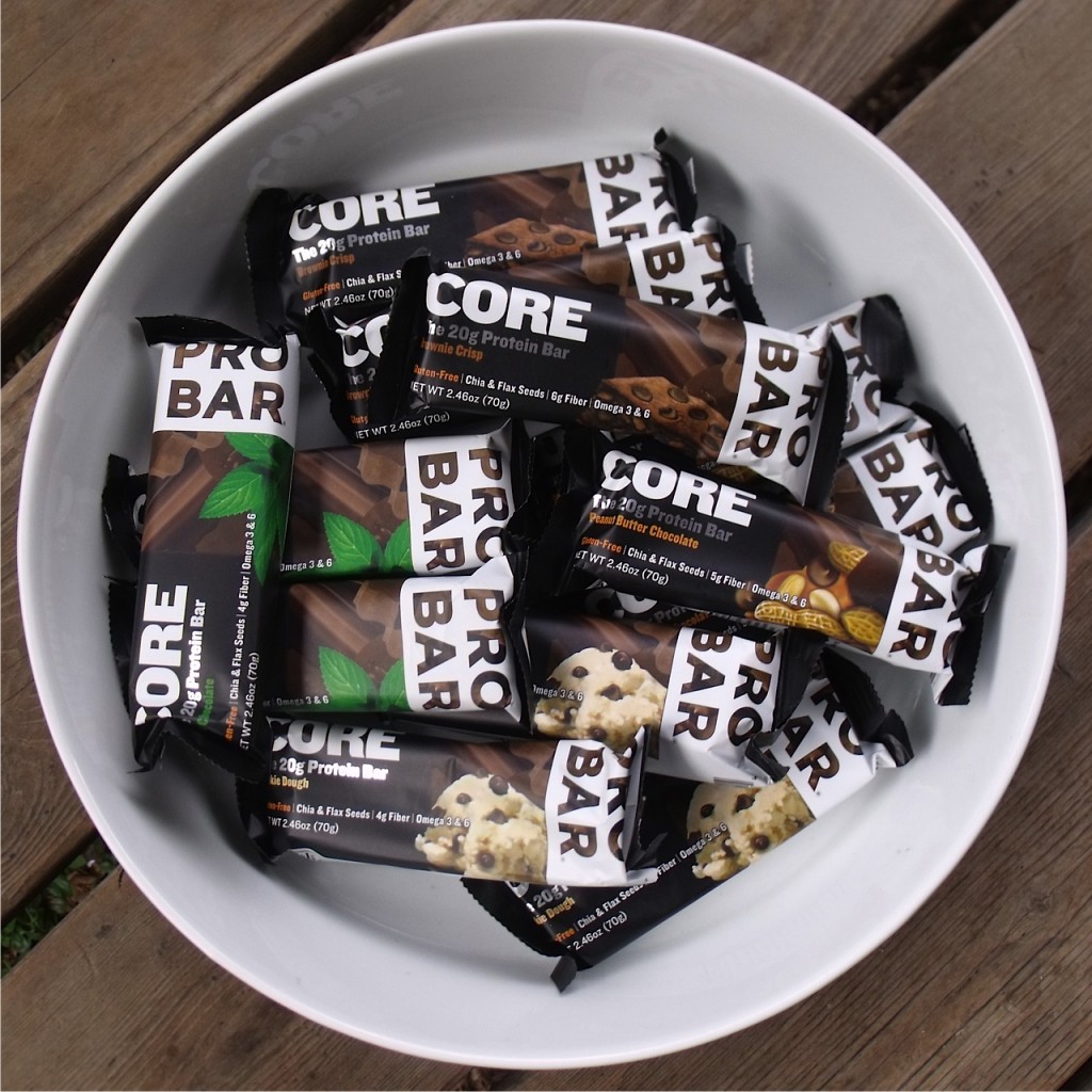
I've been a fan of Probar products for many years. I recently tried their new Core bar and was not disappointed.  Probar Core are vegan and diary free, packed with 20 grams of protein from soy isolate, boasts chia and flax seeds for hydration and contain Omega 3 & 6 making it a great post-workout recovery meal.  It's also gluten-free, but unlike many other gluten-free products I've tried it doesn't taste like cardboard. Mint Chocolate is my favorite flavor but Probar Core also come in Brownie Crisp, Cookie Dough and Peanut Butter Chocolate.  My only complaint is that all the the bars have a thin chocolate coating.  It's not that I dislike chocolate, but in warmer weather the chocolate melts into a gooey mess.  If you're looking for a easy and tasty way to add some extra protein to your diet, Probar Core may be the bar for you.

Disclaimer: Probar provided Breakheart Trail Running with sample of Probar Core Bars for tasting and review.

Saturday, June 22, 2013

Chebacco Woods Day Hike

I woke up this morning with no motivation and no real plan for the day so I thought I would check out some of the local trails.   A 30 minute drive north brought me to the trail head at Chebacco (rhymes with tobacco) Woods.  It was very humid and a little buggy which didn't help my motivation one bit.   The layout of the interconnecting trails didn't lend themselves to devising a clearly defined loop so I just started walking and let the trail in front of me determine my way.


 Walking along Round and Gravelly Ponds.

 Easy walking most of the way.

 View of Round Pond.

 A private retreat.

A see-through tree.

It didn't take long for me to get a little bored with this place.  The terrain was too flat and uninteresting for me to truly enjoy it.  I also think because I was walking aimlessly without a defined goal for the day contributed to my boredom.  If I was hiking to reach a specific destination, or trying to cover a fixed number of miles  for the day, I think I would have been more focused.

A short video of the trails in Chebacco Woods.

Don't get me wrong.  Chebacco Woods is certainly a nice place to visit.  My mind just wasn't in the game today.

More photos of the hike can be viewed here.

Wednesday, June 19, 2013

Discover Hamilton Trail Hike Report

The Discover Hamilton Trail (DHT) is a 10 mile loop beginning on Route 1A in Hamilton, MA and passing through Harvard Forest, Pingree Reservation, Bradley Palmer State Park (BPSP), Appleton Farm Grass Rides and Harvard Forest once again.  I first learned of the DHT's existence back in 2008 or 2009 while running the GAC Fat Ass 50K in Bradley Palmer.  Over the next few years I ran on portions of the DHT during training runs in BPSP and during my Bay Circuit Trail adventures. I've always wanted to do the full loop but never got around to it until this past weekend.


I started my hike at the Hamilton Town Hall and walked north on Route 1A looking for the trail marker that would indicate a turn off the road and into the Harvard Forest.  I searched several minutes for the blaze but could not find it so I decided to do a road walk that paralleled the trail and pick up the actual trail about a mile down the road.  I got a late start and it was beginning to get warm so I was looking forward to getting under some tree cover and into the cooler temperature the woodlands would provide.


Old school Post Office on 1A.

Finally found the trail.

The hiking through Harvard Forest and Pingree Reservation was very pleasant on relatively flat and smooth trails so maintaining a pace of greater than three miles per hour was quite easy. As I stopped briefly to talk to three riders on horseback, a deer crossed my path and ran off into the woods.  I bid farewell the the trio and continued on my way towards BPSP.

Muddy but easy hiking.

Trio of riders.

Horse jumping is popular in Pingree Reservation.


This was a hastily planned hike and all I had for a trail map was the one I found on the internet. It was lacking detail and I should have taken supplemental maps with me, at least one for Bradley Palmer, but I did not.  This proved to be a mistake as I went off the DHT somewhere in BPSP.  By the time I realized my error, I was too far from the missed turn to backtrack and continue on the missed section.  It wasn't a big deal but I did miss the only climb of the hike which would have taken me over Blueberry Hill and Moon Hill.

I didn't see any coyote. I wonder if they saw me?

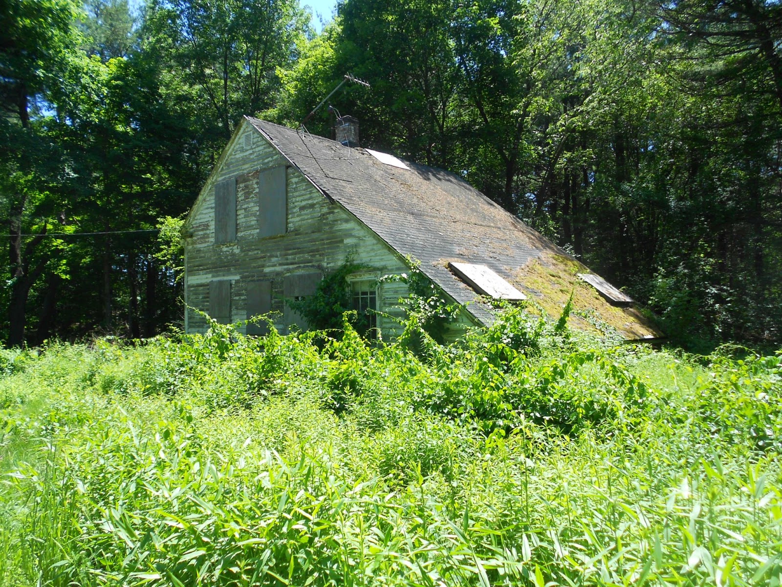
A fixer-upper.


After leaving BPSP I walked along a long dirt road and then onto a paved road past some farmland planted with native corn.  A farmer was working on his tractor in the field under the hot sun.  As I walked past him, I wondered what it would have been like to have lived in a simpler time when people grew and raised what they ate and walking was a common mode of transportation.  My daydreaming came to an abrupt end when a cyclist blurted out something as he whizzed past me.  I don't know what he said but I have a feeling it was something obnoxious.  Road cyclists are like road runners, too obsessed with pace to enjoy the journey.

Mmm,sweet corn.

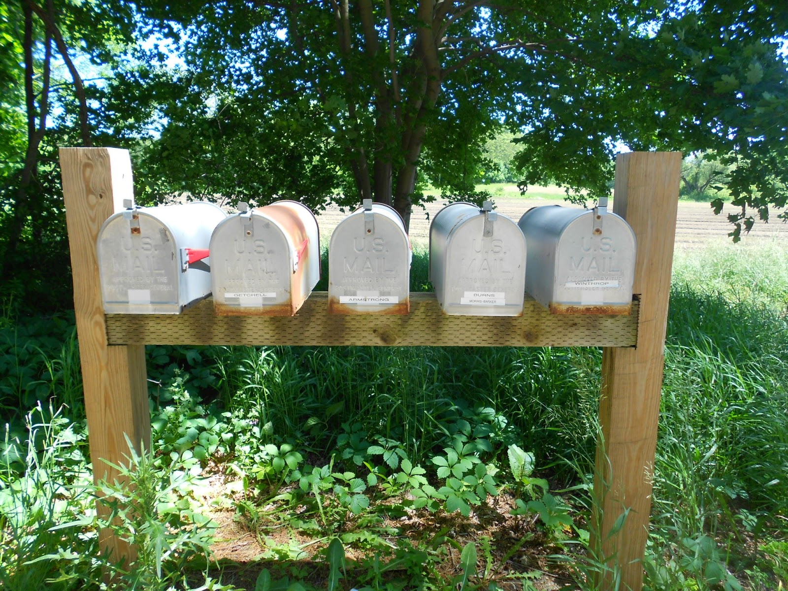
So many mailboxes but it didn't see a single house.

I was happy to leave the hot pavement behind and escape to the green solitude of the Appleton Farm Grass Rides.   The wealthy once rode in their carriages along these rolling paths.  Now, I was enjoy the soft dirt under my feet after the long road walk.  Once I left Appleton, I was less than two miles from the finish.   I entered Harvard Forest to return on the trail that I had missed when I left the Town Hall at the start of my hike.


Pinnacle at the intersection of five trails in Appleton. 

It was obvious this section of the DHT has seen little use as the trail was rather overgrown and a clear path was not visible.  As the trail descended, it became wet in many spots.  When I crossed a newly constructed footbridge the trail became even wetter and soon it disappeared completely under deep water.  There was a great deal of rain in the area during the week which turned this section of trail into a swampy mess.  There was no way through or around the flooded area so I backtracked and finished up the hike on the same road I had started it.


The not so traveled path.

This was nice but didn't help me where I needed it.

With my missed turns and detours the 10 mile hike ended up being closer to 12 miles but who's counting?

 The (sort of) Discover Hamilton Trail Loop

More DHT hike photos here.


This video comes to an unplanned end when my camera battery died a few minutes before I ran into the impassable section of trail.

Monday, May 6, 2013

Lynn Woods Hike

L
A few weeks ago I went for my first "jog" in 16 months.  It didn't go as well as I would have liked and resulted in more pain than I usually experience on a daily basis. With that failed experiment in mind, I thought I'd see if I could tolerate hiking a bit better.  Late Saturday afternoon, I went for a short "test" hike in Lynn Woods Reservation.  It was a cool, breezy day and by the time I arrived at the park the sun was casting long shadows across the landscape. 

I hiked a four mile loop at a fairly brisk pace keeping mainly on the rough fire roads with perhaps a mile or so on some rocky single-track trail.  Overall, I felt pretty good and only felt an increase in my discomfort level when climbing hills.  I think this was caused by trying to push the pace too quickly on the uphills.  When I slowed down, I didn't experience any additional pain.


Scenic four mile loop


Dirt fire road

Easy single track

Nice path along the water's edge

Breeds Pond

I'll probably try to do another test hike next weekend. If I have the same results I may attempt to complete my section run/hike of the Bay Circuit Trail that I put on hold nearly two years ago. I still have about 100 miles to cover of the 200 mile trail.

As always, I can never really plan ahead. I just need to take it one day at a time.  
Related Posts Plugin for WordPress, Blogger...