Sunday, April 23, 2023

Biking The Bay Circuit Trail - Boxford Forest to Ward Reservation (Day 3)

On Friday, I was back on the Bay Circuit Trail to continue my quest to cycle the entire trail. I arrived early at the J.C. Phillips Wildlife Sanctuary trailhead, but once again my friend Bill was already in the parking lot. He's definitely an early riser. Tony rolled into the lot shortly after, riding his bike the six miles from his house. It was funny to see him wearing an orange jacket. Bill and I were also sporting orange jackets! I was happy both decided to join me for a second ride. Perhaps they've been bitten by the BCT bug?

Overview of route - Red indicates paved, blue is unpaved.

As we started, we commented about how cold it was this morning, but we soon warmed up on the 7% climb up Moonpenny and Crooked Pond Drives. Bicycles are not allowed in the sanctuary, so we had to do a one-mile road ride to enter Boxford State Forest (BSF) by way of the North Loop trail. We rode in the direction of Bald Hill, but the BCT turned onto Thomas Road, and we avoided the 246-foot climb. The four miles of trails in Boxford Forest were generally easy biking but we did have to find our way around flooded sections a few times.

There have been many improvements to the trail since my last visit. These wet sections of trail were far less numerous than what I encountered on my 2011 run. 

He rides rough trails on skinny tires and he's still smiling. He's a sick puppy!

While in BSF, Bill spotted a stone chimney about 100 feet off trail. It was surrounded by heavy growth so we couldn't get a closer look. I researched online to see if I could find information about the chimney without success. While researching the history of BSF I learned that it was home to the first Sentinel Anti-Ballistic Missile site in the continental United States. The project was started in 1968 but never completed due to local opposition and a change in military defense strategy. 

This is not the only chimney I've seen in the middle of the woods.

Beavers are active in Pout Pond.

Leaving the forest, the BCT is on roads for one mile before entering Harold Parker State Forest (HPSF). The first 1.5 miles of single-track in HPSF were rough but rideable. This would change as soon as we exited the Leland Parcel section. Mountain biking trails have difficulty ratings similar to downhill ski runs. Easy trails are rated green, while blue is intermediate and black trails are considered very difficult. 

Up to this point we were on green trails but the next 3.5 miles of single-track were rated blue. The difficulty level was immediately evident. The trail was a minefield of rocks and roots of all sizes. The difficulty was compounded by the constant twists and turns, and ups and downs. There was very little level trail the entire way.

We were about halfway through HPSF when we crossed paths with two mountain bikers coming in the opposite direction. Tony knew them so we stopped and chatted awhile. When they heard we were riding the Bay Circuit Trail one said, "The BCT ahead of you is much harder than what you just rode". OH GREAT! She wasn't joking either. We got through it by riding slowly and walking when the trail got too technical. We're senior citizens after all, and prefer to remain upright. We don't bounce off the ground like we used to. 😆

Slow and steady. Live to ride another day.

No trail, no problem.

When I ran the BCT, I dreaded road sections. But now, I rejoiced when we finished the HPSF section and began a 1.5-mile paved section leading to Ward Reservation. When on foot, the BCT bypasses this road section, entering the Skug River Reservation and connecting to Mary French Reservation and Great Meadow Reservation on trails. These reservations are managed by The Andover Village Improvement Society and bicycles are not allowed on their properties. Today, I thanked them for that!

Entering Ward reservation, we were faced with our first substantial climb of the day, gaining 241 feet in .75 miles with a maximum grade of 17.2%. It began on rocky single-track, followed by a side hill carriage road and finished on a grassy meadow atop Holt Hill. At 423 feet, Holt Hill offered a 180-degree view with the tall buildings of downtown Boston in sight 15 miles south. After a brief rest, we made a fast descent off Holt Hill and ended our BCT ride at the intersection of Prospect Road and Route 125 in Andover.

The official summit.

View from Holt Hill.

My third ride is in the books and I'm about two miles behind my BCT run pace. The next couple of sections of the BCT have a greater percentage of roads than my last two rides so I should be able to jump ahead of my 2011 run schedule. Time will tell.

Total distance - 13.8 miles, 42.3 cumulative.
Paved - 3.5 miles, 14.2 cumulative.
Unpaved - 10.3 miles, 28.1 cumulative.
Elevation gain - 1360 feet, 3422 cumulative.
Max grade - 17.2%
High point - Holt Hill, 423 feet
Towns traversed - Boxford, Middleton, North Andover, Andover,
Green spaces visited - Boxford State Forest, Harold Parker State Forest, Ward Reservation

Sunday, April 16, 2023

Biking The Bay Circuit Trail - Prospect Hill to Boxford State Forest (Day 2)

Similar to my 2011 run, I was joined by two friends for section 2 of the BCT. The forecast called for unseasonably warm weather with a high temperature into the 80s. This would become a factor in the latter stages of the ride. We met at the Prospect Hill trailhead with an eclectic mix of bicycles. Tony had a gravel bike with skinny tires, Bill had a hardtail mountain bike, and I brought my very heavy fat bike. I had to give Bill the "Goldilocks Award" for picking the bike that was "just right" for the trail conditions.

Overview of route - Red indicates paved, blue is unpaved.

There was no time to warm up the legs as we were immediately faced with a steep climb up Prospect Hill. Prospect Hill is a glacial drumlin rising 268 feet above sea level and was the high point for the day. The climb was about a half-mile long with occasional blowdowns to make things interesting.  I was struggling with the weight of my bike, and I think Tony was having some difficulty getting traction with his smooth tires. Bill was ahead and quickly out of sight. Unfortunately, the hard effort to the summit was not rewarded with any views. 

The descent down the other side of the hill and through Dow Brook Reservation was slow and tedious. The trail off the backside of the hill was twisty, steep and rocky and the single-track in Dow Brook was blocked by numerous blowdowns. It required dismounting the bike, lifting the bike over the fallen tree and getting back on the bike. In some cases, we only rode a few hundred feet before repeating this process. Bill helped me get my bike over one of the blowdowns that was waist high. He commented on the weight of the bike. I don't think he believed it was as heavy as I told him it was until he actually had to lift it!

Numerous blowdowns large and small blocked our path.

I was happy to see Willowdale State Forest ahead as we sped downhill though Marini Farm. The BCT though the Pine Swamp section of Willowdale is mainly on easy trails and old carriage roads. Other than the short road sections late in the ride, this was the easiest riding of the day and our pace quickened. That didn't prevent me from being passed by a solo mountain biker. He was the only one we saw all day.

Smooth and easy trail in Willowdale was appreciated.

Crossing Route 1 into the Hood Pond section of Willowdale, the riding remained relatively easily before Linebrook Road. From here, the BCT runs mostly on top of an esker for the next two miles. There were points where the trail ran very close to the edge of the steep-sided esker. A fall here could have been serious.  In mountain biking lingo "babyheads" refer to rocks the size of a baby's head. The esker trail had its share of babyheads which slowed my progress. That and the short, punching climbs at times.

Frankly, I was happy as heck to get off that esker when we reached Georgetown-Rowley State Forest. We made a short detour to avoid a flooded section of trail only to be greeted by another section of flooded trail. I had a moment of deja vu as the same thing happened to me when I ran this trail in 2011. We managed to keep our feet dry by walking on a stone wall while pushing our bikes through the deep water. Three miles later we were out of the woods and onto our first stretch of pavement. To me, it was a welcomed sight!

Wet and wild in Georgetown-Rowley State Forest.

Bill had been taking the lead most of the day, so when Tony and I exited the French Family Woodlot and didn't see him, I assumed he missed a turn. My phone rang about five minutes later and Bill confirmed my assumption. When Bill met back up with us, we took a much-needed break at the Boxford Community Kitchen on Elm Street. Tony was having some cramping due to the heat and Bill and I were out of water. We hoped a cold coke and some salty chips would breathe new life into us. It did the trick, at least temporarily.

Boxford Community Kitchen was a welcomed oasis.

We were on our way again and after one mile of road riding we turned into Lockwood Forest. One more mile of single-track dumped us out onto Middleton Road where we ended the ride at the entrance to the J.C. Phillips Sanctuary. Tony had 1400+ feet of elevation gain on his Wahoo while I showed 1300+ feet on my Garmin which was acting wonky on the climb up Prospect Hill. That's a fair amount of gain for a 18.2-mile ride. This ride was a challenge for me, maybe even more than I anticipated, but I'm looking forward to my next ride on the BCT. 

Crossing Fish Brook in Lockwood Forest.

(A note regarding the above photos: Although these photos are from my 2011 run, they depict the conditions we encountered on the trail. I felt I was the weak link on this ride, and I did not want to delay the group further by stopping to snap pictures.)

Total distance - 18.2 miles, 28.5 cumulative.
Paved - 2.9 miles, 10.7 cumulative.
Unpaved - 15.3 miles, 17.8 cumulative.
Elevation gain - 1400 feet, 2062 cumulative.
Max grade - 32.8%
High point - Prospect Hill, 268 feet
Towns traversed - Rowley, Georgetown, Boxford
Green spaces visited - Prospect Hill, Dow Brook Reservoir Lands, Linebrook Woods Conservation Area, Willowdate State Forest, Cleveland Farm State Forest, Georgetown-Rowley State Forest, French Family Woodlot, Lockwood Forest


Tuesday, April 11, 2023

Biking The Bay Circuit Trail - Northern Terminus to Prospect Hill (Day 1)

It’s been nearly twelve years to the day when I started my journey to run the length of the 230-mile Bay Circuit Trail (BCT). The adventure didn’t go exactly to plan, but I eventually completed the entire trail. Now, here I stand at the northern terminus of the BCT at the Parker River National Wildlife Refuge Visitor Center, about to attempt my second end-to-end adventure from Newburyport to Kingston. Unlike last time, I will not be traveling by foot, but instead by bicycle. With practically zero mountain biking experience, this will be a challenging ride (also because I don’t own a mountain bike 😳).

The official northern terminus of the Bay Circuit Trail

Overview of route - Red indicates paved, blue is unpaved

There is conflicting information on the BCT website with regards to the Spencer-Peirce-Little Farm. The interactive map shows the bike route passing through the farm, but the trail description indicates "bicycles not allowed." I choose to bypass the farm, departing the visitor center parking lot onto Ocean Avenue. It wasn't long before I was passing Tendercrop Farm on busy Route 1A. Tendercrop Farm was once home to the only buffalo on the BCT. Buffy the buffalo passed about four months after I visited her on my 2011 run of the BCT. 

 Buffy is now grazing on the big prairie in the sky (photo from 2011 run)

When I saw a domed house mentioned in the trail guide, I knew it was just a matter of feet before I would turn left into Old Town Hill Reservation. Little's Trail in the reservation would have been ridable even for me but I was on my Trek 7000 with road touring tires and was concerned I could slip when cornering as the trail was covered with dry leaves. I decided to hike-a-bike for the 0.8 miles through the woods. I felt it was good practice for all the future hike-a-bikes I would be doing over the next 200 miles.

The not-so-famous domed house on the BCT

It was dry in Old Town Reservation 

The 35 mph wind gusts slowed my progress as I peddled through the open expanse of the Newbury Salt Marsh and over a bridge spanning the Little River. The salt hay here is harvested year-round and is used as mulch for landscapers and gardeners throughout New England. After crossing Little River a second time, I began the steep climb up Old Town Hill. I was able to ride some of the approach to the summit but had to walk once the grade hit 14%. Once I reached the summit, I rode a short distance on the Ridge Trail before dismounting again for the -22% descent down Switchback Trail. Yes, I was getting really good at this hike-a-bike thing!

Little River and the salt marsh beyond

The only view of the day. Atop Old Town Hill with the town of Newburyport and the Atlantic Ocean in the distance.

Coming down Switchback Trail with a blowdown ahead. There was no way around it, so I had to lift my bike over one limb and under the other.

The remainder of the ride was uninspiring to say the least; a 5.5-mile ride on Route 1A south to Prospect Hill in Rowley. At least there was a one-foot-wide shoulder to give me a false sense of safety.

Total distance - 10.3 miles
Paved - 7.8 miles
Unpaved - 2.5 miles
Elevation gain - 662 feet
Max grade - 14.2%
High point - Old Town Hill, 162 feet
Towns traversed - Newburyport, Newbury, Rowley
Green spaces visited - Old Town Hill Reservation

Friday, January 6, 2023

Chipping Away The East Coast Greenway

The East Coast Greenway (ECG) is a 3,000mile route passing through 15 states and the District of Columbia. Its southern terminus is in Key West, Florida and the northern terminus in Calais, ME on the Canadian border. Approximately one-third of the route is on protected bike paths and the remaining 2,000 miles on public roads. The goal is to have all 3,000 miles off-road. This would be an amazing accomplishment but it's a slow process. I doubt I'll see it in my lifetime.

Over the past few years, I have biked a little over 10% of the route. In the beginning, this was by happenstance as I often rode bike paths that were part of the ECG route. In 2022, I made a conscious effort ride more of the greenway. In late September and early October in did overnight bike trips in Maine and Massachusetts and did another October ride in CT. To date, I have covered 315 miles of the ECG, including the spur trail to Cape Cod.

Below are sections of ECG I have completed in eight different states. New Hampshire is the only state where I have completed 100% of the route. So many more miles to go!

Southern-most point in continental USA to Florida Keys Heritage Trail - 5 miles.

Florida Keys Heritage Trail, Islamorada to Key Largo, FL - 23 miles.

Miami Beach, FL - 3 miles.

Charleston, SC - 4 miles.

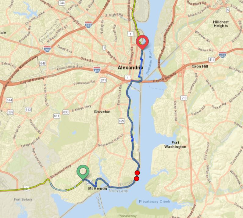
Mt. Vernon Trail - Mt. Vernon to Alexandria, VA - 12 miles.

Farmington Canal Heritage Trail - Farmington to Simsbury, CT - 12 miles.

Blackstone River and East Bay Bike Paths - Bristol to Woonsocket, RI - 28 miles.

Cape Cod Canal Trail - Buzzard Bay to Bourne, MA - 5 miles.

Cape Cod Rail Trail - Yarmouth to Wellfleet, MA - 31 miles.

Upper Charles Trail - Milford to Sherborn, MA - 9 miles.

Wayland, MA to Portland, ME - 183 miles.

I hope to ride an additional 300 miles of the greenway in Maine this year. This could take the form of a point-to-point ride from Portland to Calais or a Portland-Bangor-Augusta-Portland loop.
 I'm leaning towards the loop route but don't have a firm plan at this time. There's much planning to be done for a ride this long. I guess that's what winters are for.

Possible Maine ride in 2023.

Stay warm!

Thursday, November 24, 2022

Riding The Farmington Heritage Canal Trail

In late October, I ventured to Central Connecticut for a two day exploration of the Farmington Heritage Canal Trail. In the 1800s, the canal extended for 82 miles from New Haven Connecticut to North Hampton, Massachusetts. As with other canals of that time period, it was rendered obsolete with the introduction of railroads. The Farmington Trail is now a 56 mile mixed-use path running from New Haven to the Massachusetts border in Suffield. 

From Bloomfield to the east, the East Coast Greenway connects to the Farmington Trail in Simsbury continuing south to New Haven and beyond. I decided to overnight in Simsbury, allowing me to ride south on day one and north on day two covering the majority of the trail. Both days were cold and windy but at least the sun was shining. The trail north of Simsbury is more scenic than the southern section and also has less street crossings.

Although it was past peak foliage, there were still some colors visible. I had a great time riding through forests, past farmlands and over rivers.  It's definitely worth a return trip in the future. Also, I recommend Rein's New York Style Deli just off Interstate 84 in Vernon, CT. I had an excellent pastrami and rye on my drive back to MA.

Taking a break at a shelter in Farmington. The East Coast Greenway trail marker overhead indicated 2,184 miles to Key West. Maybe I should have kept riding south? I'm not a fan of winter.

Crossing over the Farmington River. Water level is low due to summer drought.

View of Talcott Mountain from Avon. Heublein Tower is barely visible but if you look closely you'll see it.

Close-up of the tower and estate on Talcott Mountain. The interesting history of the tower can be found HERE.

A scenic stretch through the forest in Granby(?)

Beautiful farmland in Suffield.


Potato field in Southwick MA. Fall harvest was in full swing.

Some unexpected artwork inside a Southwick porta-potty. I don't know if this Link is the same one I found on Etsy.

And this one on the outside of a porta-potty in East Granby. I know my artist friend Emily would have had a witty comment if she saw this. Hats off to the unknown artist!

Happy Thanksgiving!


Saturday, November 19, 2022

Home to Hudson Overnight Bike Tour - Day 2

Well, day two did not unfold entirely as planned. I had mapped a 57 mile route from Hudson to home but decided to stop after 33 miles at the Bedford Depot on the Minuteman Bikeway. I’ve ridden the Minuteman Bikeway from Bedford to Cambridge and the Northern Strand Community Trail from Everett to Saugus numerous times.  I felt I wasn't missing out on anything new by shortening the ride except for the section through Somerville which didn’t interest me much anyway. It was still the most climby (made up word meaning a lot of uphill riding) day I’ve had on a bike with over 1800 feet of elevation gain.

Day 2
Distance - 59.6 kilometers (33.3 miles) 
Elevation gain - 560 meters (1,838 feet) 
Max grade -12.0%

Hudson to Bedford via the Atlantic Coast Route (ACR)

Getting out of bed after a not so restful sleep, the first thing I did was to check the weather. The temperature in Hudson was in the upper 30s. Yikes! I had checked the forecast before leaving Saugus the day before so I was prepared for colder weather. I needed a light insulating layer for most of the ride as the high for the day was only in the low 60s. I didn't want to ride in 30 degree weather so I ate breakfast and waited for it to warm a bit. When the temperature was in the 40s I packed up the bike and I departed the hotel at 7:30.

There was fast moving, rush-hour traffic on route 62 so before I left the hotel parking lot I attached a rear blinking light to my bike. Unfortunately, it didn’t work. I thought I charged the light before leaving on this trip but evidently I did not. I made a mad dash south-west down the busy road for one mile and turned north onto Sawyer Hill Road in Berlin. I’m always concerned when the word “HILL” is in the name of any street I’m about to ride. Later in the day I rode Nagog Hill Road in Littleton and Strawberry Hill Road in Concord. As I said before, it was a climby day!

I took a break here after climbing a difficult hill. These three stooges were not impressed. 

Sawyer Hill Road was true to its name. I faced rolling hills followed by a longer, sustained climb on the four mile ride to Bolton. Three more miles of rolling hills in Bolton brought me to 600 feet and the high point of the day in Harvard. What goes up eventually comes down and I was rewarded with a slight two mile descent. I had a sense of déjà vu while riding through Harvard. I think it's because I ran a very hilly 10 mile road race here in 2005 named the Apple Harvest Ramble which may have been on the same road I was currently riding. I believe I placed 3rd in my age group. Surely, the older I get, the faster I was!

Unlike yesterdays ride which was through busy cities and suburbs, I was enjoying todays ride through these smaller, less populated towns. This part of the state is known for its farms and orchards. I traveled pass many on this ride including Berlin Farms in Berlin (of course), Nashoba Valley Winery in Bolton and Nagog Hill Farms in Littleton. I couldn't help but notice many apple orchards are perched atop hills. I wondered if there was an agricultural reason for this.

Berlin Farms

Nagog Hill Farm

After 14 miles on the Official ACR I reached the Boston spur in Littleton. I still had another 19 miles to the town of Bedford but I was making progress. I barely made it across the train tracks on the Fitchburg Route Main Line as the crossing gate began to close. I stood and watched as a fast moving train passed by another decaying train depot. It a shame to see these old buildings being neglected.

Old rail station in Littleton.

An important consideration when exercising for a long period is to stay hydrated. The downside to staying well hydrated is that you’ll eventually need to find a bathroom. This is not an issue when you're trail running in the woods but when you’re riding on public roads there aren’t many options. By the time I reached Acton center I felt my bladder was about to burst. Luckily, I passed the Acton fire station and was able to use their bathroom. Crisis averted!

A short while later I crossed the Bruce Freeman Rail Trail near Route 27 and entered into Concord. After climbing 1.5 miles to Strawberry Hill Road I was again rewarded with a nearly 2 mile downhill to Barrett’s Mill Farm. After negotiating my way through a busy intersection in West Concord, I was again on Route 62 for the final four miles to Bedford Depot. With shorter days ahead this will likely be my last tour for 2022, but it wont be my last. 

Back to Day 1

Monday, November 14, 2022

Home to Hudson Overnight Bike Tour - Day 1

Shortly after returning from my Maine bike tour I begin planning a second overnighter. I like maps and designing routes, whether for running, hiking or cycling, is a process I’ve always enjoyed. I live approximately one mile from the East Coast Greenway (ECG) where it passes through Saugus on the Northern Strand Community Trail. I cross-referenced the ECG map with the Atlantic Coast Route (ACR) trail map to see if the routes intersected nearby as they do in Portsmouth, New Hampshire. By comparing maps, I could see that the trails intersect in the town of Berlin approximately 33 miles west of my hometown.

The ECG travels in an east-west direction through Berlin while the ACR travels in a north-south direction. (The East Coast Greenway has been rerouted since my ride and no longer goes as far west as Worcester before turning south to Rhode Island, thereby shortening the distance to Providence by 30 miles.) Further investigation of the ACR map revealed a Boston spur to Alewife station in Cambridge via the Minuteman Bikeway. From there I could use city streets through Somerville and Charlestown to get back on the Northern Strand and home.

My plan for this overnighter was to ride 47 miles on the ECG from Saugus to Hudson on day 1. On day 2, I would pick up the ACR in Berlin, turning north towards Littleton. In Littleton, I would take the Boston spur for the return to home. This would make for a 57 mile ride on day 2 and 104 total miles for both days. Total elevation gain would be approximately 3,500 feet.

Home to Hudson Loop via the East Coast Greenway and Atlantic Coast Route

OK, I may love maps but you're probably bored out of mind by now so let's get on to the ride itself.

Day 1
Distance - 74.7 kilometers (46.4 miles)
Elevation gain - 484 meters (1587 feet)
Max Grade - 10.6%

Home to Hudson via the East Coast Greenway

After breakfast and some last minute packing I departed my house at 10:30am. The forecast called for a sunny, 70 degree day. Perfect riding weather! I was soon on the Northern Strand riding through the cities of Revere, Malden and Everett. It's a nice local bike path but there are too many busy street crossings in Malden. After passing under Route 16 I took the Mystic River path to the Encore Casino. 

I couldn't afford to lose any money so I kept riding.

Crossing the Route 99 bridge over the mystic river, the ECG is well marked through Charlestown. I commuted to work for years over the Tobin and Zakim bridges but it was an entirely different perspective riding my bike under them. Pretty cool! Before reaching the Charles River I rode past the Charlestown Naval Yard and the USS Constitution. I'm embarrassed to admit I didn't even notice the old ship as I was more concerned about avoiding tourists and pedestrians out for a stroll on this fine day.

Riding under the Tobin Bridge in Charlestown

Paul Revere Park Playground under the Zakim Bridge

The next 12 miles were traffic-free riding on the Dr. Paul Dudley White bike path which parallels the Charles River. As I passed the Charles River Canoe and Kayak launch area I saw a woman waving at me. At first I thought it must have be meant for another person but when she asked if I was riding the East Coast Greenway I knew she was waving at me. She was with Timberline Adventures in Colorado and co-leading a 825 mile guided tour on the ECG from Calais, ME to New York city. She was waiting for a few cyclists on the tour who were spending some extra time exploring Boston. I explained I was only out for a two day ride but would like to do a longer tour in 2023. 

The bike path in Boston and Alston-Brighton was paved and exposed to the sun. Although it was late September, I was feeling the heat of the sun beating down on me. When I reached Watertown I was pleasantly surprised to find dirt paths meandering under a canopy of trees. It felt much cooler in the shade. The ECG was not marked and I made a wrong turn when leaving the river behind. My GPS quickly alerted me of my error and I was back on track again.

Charles River in Boston

View of Charles River in Watertown

After two miles of busy traffic on Route 117 in Watertown, I reached the Mass Central Rail Trail in Weston. I enjoyed this quiet, four mile trail knowing Route 27 was soon to follow. I was not looking forward to this twisting, two-lane road with little to no shoulder. Leaving the trail, I took a short break at the Wayland Country Club to refill my water bottles.  I saw several golfers enjoying an alcoholic beverage in the afternoon sun. I thought to myself, "I hope they're not heading in my direction any time soon".

This train depot in Weston has seen better days. So have I.

Mass Central Rail Trail in Weston (photo taken from Google)

The next 14 miles on Routes 27 and 62 were a little stressful. I was constantly checking my mirror for oncoming traffic. Most drivers were courteous and gave me plenty of room but occasionally vehicles passed a little to close for comfort. I did get a short reprieve from traffic when I reached the Assabet River Rail Trail. My lower back had been bothering me for the past few miles so I stopped here to do some stretching and take ibuprofen. The stretching seemed to help and I rode pain free to my destination for the evening.

Google image of a narrow, shoulder-less street I had to ride. Traffic was heavy when I rode it in the afternoon.

Old boxcar on the Assabet River Rail Trail

After all the hectic miles, I was relieved to reach the Holiday Inn Express in Hudson. It was directly on the ECG route and the only lodging option. It was fitting that the final mile to the hotel was uphill. After checking in and getting to my room, (not easy getting a fully-loaded bike on a small elevation) it was time for a well-deserved shower. The only thing left to do was to eat, rest and do it all over again tomorrow!


Related Posts Plugin for WordPress, Blogger...