Saturday, April 25, 2015

Orienteering In Needham Town Forest

I dove 40 minutes to Needham to participate in my second NEOC meet in seven days. The morning was sunny and cool so it was a perfect day to be in the woods. One thing I really like about these meets is that the course opens at 10am but you can start your race any time between 10am and 12pm. I took advantage of a later start and slept in a bit and enjoyed breakfast and coffee before hitting the road.

Course map with location of 11 controls.

The topography in Needham Town Forest was not as challenging as it was at the meet last week so I decided to jog the flatter sections instead of walking them like I did at Breakheart. I was making excellent time, finding the first three controls in less than eight minutes and beginning to think the course was too easy. Then, I carelessly ran past control #5 and had to backtrack to locate it. Also, in my haste to reach control #8 I misread the map which put me slightly off course. When I realized my error, I shot a bearing from my location on the map to the control and found it pronto! But these mistakes cost time. (After checking results, I was in 3rd place after 4 controls but fell to 8th place after 8 controls. Final placing was 12th)

Then the wheels fell off completely .

The race director had warned us there were many phantom trails created by mountain bikers that were not marked on our maps. Up until this point, they hadn't created a huge problem for me but that all changed on my way to the 10th control. I got totally confused by the number of unmarked, intersecting trails and was unsure of my location on the map. While I had located the first nine controls in 43 minutes, it took another 22 minutes to locate the 10th control. That totally blew the race for me. After locating the elusive control I quickly found the 11th and last control and jogged to the finish.

Can you locate control #7?

It's under the yellow arrow.

Although I was a little disappointed I spent 30% of my time on the course looking for a single control, I was pleased I didn't give up without finding it. Each race is different and I feel like I learn something that will help me improve at the next meet. Maybe you can teach an old dog a new trick!

“Truth lies within a little and certain compass, but error is immense.” - William Blake

Tuesday, April 21, 2015

North-South Trail Trek - Section #3.

I was back on the NST with my daughter to cover the 17 mile section from Arcadia WMA in Exeter to the Nicholas Farm WMA in Coventry. The hike turned into an 18 mile day when a large area of logging activity caused us to miss a turn at mile 13. It wasn't a big deal but the 75 degree temperature and bright sunshine we had been exposed to for hours was beginning to wear us down. It's a rare day on the trail when I don't get temporarily misplaced. If it wasn't for the "Entering Connecticut" sign we still could be out there!

The first third of the hike was very scenic as we walked through mixed forest and crossed or walked alongside several rivers and brooks, some complete with waterfalls! The middle third was on remote, rolling dirt and paved roads. To emphasize the remoteness, only two vehicles passed during this 5 mile stretch. With the sun high in the sky, there was little shade to offer protection from the sun. The final third of the trail passed through open meadows and thick pine forests which felt much cooler than the open road section. 


 Rolling terrain but more uphill than down. (photo credit - Ron Correia)

Trout fisherman trying without success at Roaring Brook Pond.

The reflection would be spectacular in autumn.

Rock hopping over a wet, muddy area.

Chimney in the middle of the woods of Arcadia WMA.

This path was lined with small pines for a considerable distance.

Smooth, calm water of the Flat River.

This pine needle covered section of trail was one of my favorites.  

Small ripples of the fast moving Falls River.

Hanging out at Stepstone Falls.


More stepstone falls.


One of the remote dirt roads we traveled.

View from a trestle bridge.

A large meadow in Nicholas Farm WMA. This was once a working dairy farm.


Walking beside an unnamed river in Nicholas Farm.

My daughter walking through a thick stand of pines.


Here is a short video highlighting the rivers and falls.

Stats:
Total Miles: 18.1
Elapsed Time: 6:20:00
High Point: 476 ft
Low Point: 128 ft
Elevation Gain: 1322 ft
Elevation Loss: 1135 ft


Monday, April 20, 2015

Orienteering In Breakheart Reservation

On Sunday, I participated in my first orienteering meet of the season at Breakheart Resevation. Although I'm very familiar with the trails in Breakheart, I don't know every boulder, hillside, cliff, noll, and ditch. And that where most of the controls where placed on the yellow course I chose to navigate. I was definitely a little rusty and it took a few minutes to get into the map and compass mindset but once I was off to the first control I started to feel more comfortable.

There were 13 controls on the 2.5 km course, with the distance being measured in a straight line from one control to the next. Since the most direct path is not always the easier terrain to traverse, it may not be the quickest. Decisions about what route to take from one control to the next can have a big impact on the distance you have to cover. I did not wear my GPS but I probably covered at least a 5K in reaching all the controls. I didn't always take the most efficient route and took too much time looking for a few controls, so overall I'd give myself a C+ for the day. 


A control at the base of a cliff. The lack of vegetation in early spring made it easier to locate some of the controls.

If you look closely there is a control to the left of the pole.

Following a brook downhill to a trail that will take me to the general area of the next control.

Low bridge!

I stopped to admire this cool reflection of the tree in the pool of water. 

Wednesday, April 8, 2015

North-South Trail Trek - Section #2

This past weekend I hiked a 15 mile section of Rhode Island's North-South Trail (NST) from Meadowbrook Pond in Richmond to Browning Mill Pond in Exeter. The record-breaking snowfall this winter had kept me off the trails since late January so it was very satisfying to finally see the brown earth beneath my feet. That's not to say the NST was completely snow-free. It wasn't. But with the exception of a long snowy stretch on the Meadowbrook Trail though the 2400 acre Carolina Management Area (CMA), the majority of the miles were smooth sailing. Except I'm hopelessly out of shape! 


GPS track courtesy of Ron Corriea


You can see from the elevation profile that I was hiking uphill most of the way.

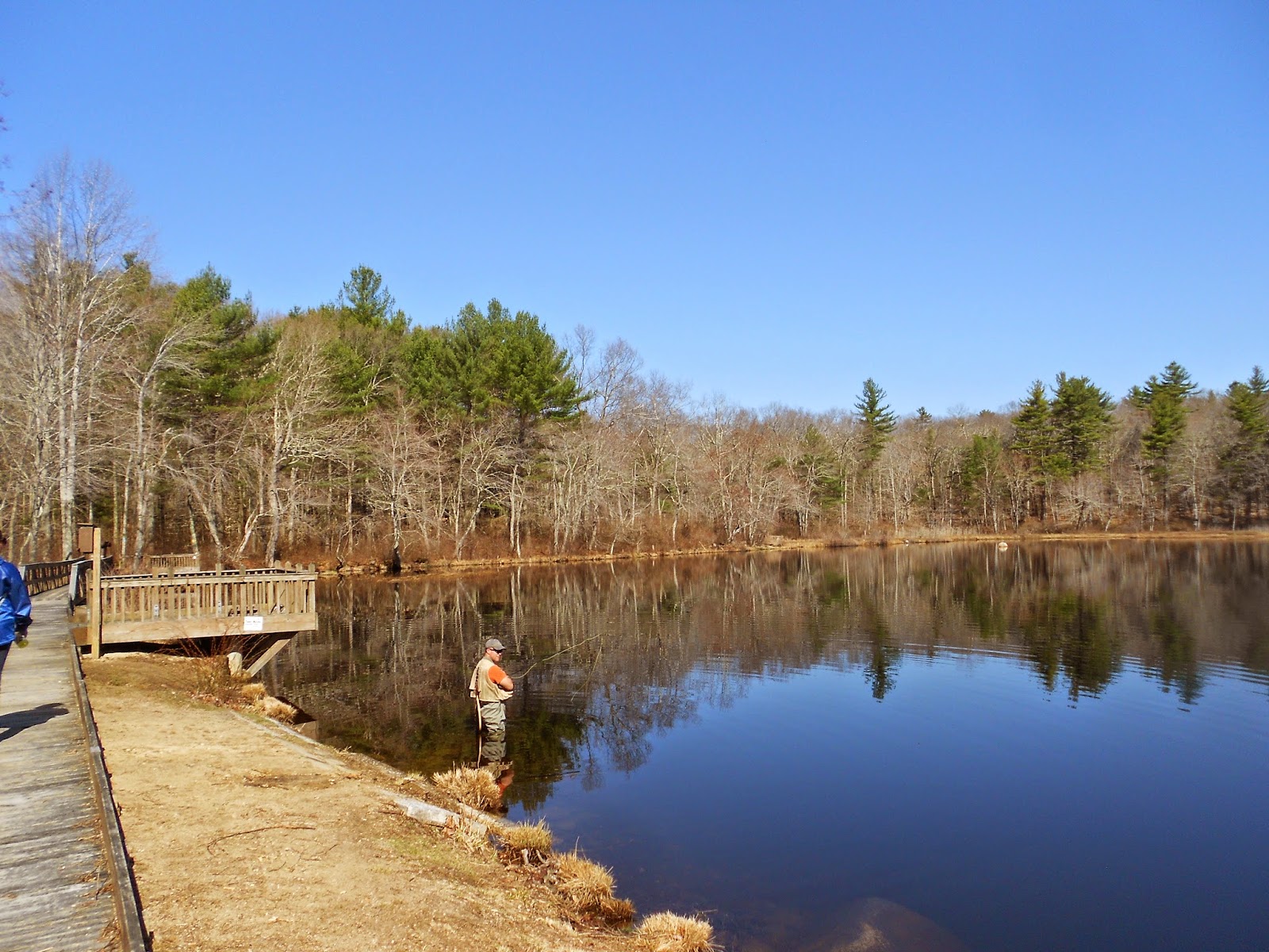
A cold wind was whipping off the water when I started the hike from the waterfront parking lot of Meadowbrook Pond. Tucking into the woods offered protection from the biting wind and I soon began to thaw out. Shortly, the trail opened onto a vast meadow of a sod farm. I bet it would be a sight to see in the summer with a broad carpet of green grass framed by woodlands and a bright blue sky above. The NST flanks the eastern side of the field before entering the woods to the north. Off I went with great expectation!


Icy water of Meadowbrook Pond


Walking the dirt road around the large sod field.

Expansive sod field


The trail was well blazed and easy to follow.


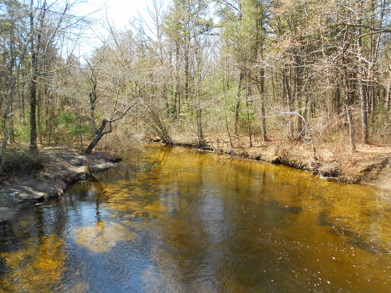
The trail next to Pawatuck Brook

Historic cemetery in Carolina Management Area

At approximately three miles I left the woods for a brief road walk before re-entering the CMA on Meadowbrook Road. This dirt fire road was mostly shaded so much snow, ice and water blocked my path. I slowed my pace and carefully made my way around the icy sections but fortunately, the snow was soft and not very deep so it wasn't all bad. Still, I was happy when the trail left the CMA a few miles later. That is until I realized what was ahead of me. A tortuous three and a half road walk!


A short reprieve from the snow and ice on Meadowbrook Road.


Heavy equipment abandoned on the trail.

I'm not a big fan of road walks but I can tolerate them if there's something interesting along the way to distract me. There wasn't anything of interest along these roads. Open fields, a golf course, a few homes and not much else. I did pass a small roadside pool of water where the frogs were happily singing a tune. I was amused but the feeling faded quickly. There was also farm about half way though the road section. It was a welcome distraction, albeit brief, as the neuromas in my feet were beginning to hurt from pounding the pavement. I needed to get on dirt, and soon!


Long, torturous road walk.


Meadowburg Farm


What's hidden under there?

One of the high points of the road walk. A pond on the corners of Buttonwoods and Carolina Nooseneck Roads complete with tug boats.

The final five miles would take me to the southeast corner of the Arcadia Management Area where my car awaited at Browning Mill Pond. As soon as I left the road and entered the woods I could see the topography was very different from what I had just walked on in the Carolina Management Area. Where the NST was flat and smooth through the CMA, the trail here was undulating with plenty of rocks and roots. It was also flooded in many sections requiring rock hopping and using downed trees as bridges whenever possible. I still managed to get my feet soaking wet which resulted in one blister. A small price to pay for an enjoyable day on the trail.


Rocky trail begins


Water, water everywhere on this section of the NST.

Although the wet trail was an obstacle, it wasn't the most difficult one. That distinction was held by a significant boulder field that was left behind when the Wisconsinan Ice Sheet receded 20,000 years ago. The trail passed directly though this minefield of narrowly spaced boulders, some the size of washing machines and refrigerators. I was happy to accept this challenge as it made the journey more interesting, but I would have preferred if it came earlier in the hike when my energy was high. After 12-13 miles of hiking i was tired, and negotiating the boulder field was exhausting. This was easily the most difficult and slowest mile I covered during the hike. 


A trail of boulders.

And it keeps getting better(?) Yes, this is the trail.

Just for scale (photo courtesy of Ron Corriea).

I'll probably be back on the NST in two weeks with my daughter when we'll cover 17 more miles of Rhode Islands longest trail. Spring at last!

Stats:
Total Miles: 14.8
Elapsed Time: 5:35:00
High Point: 435 ft
Low Point: 52 ft
Elevation Gain: 839 ft
Elevation Loss: 661 ft

Report on the North-South Trail Section #3
Related Posts Plugin for WordPress, Blogger...