Sunday, December 28, 2014

GAC Fat Ass 50K Course Recon

With the 2015 GAC Fat Ass 50K just one week away I decided to check out the race's 10K loop in Bradley Palmer State Park. I was certain the many, often heavy rainstorms that occurred this month would have left the trails in less than idea condition. I was right, but the damage was far less than I expected. There is slight to moderate erosion on some of the carriage roads and a few water obstacles on the course. The worst trail erosion is between trail markers #17 and #22 ( see map below). The largest body of water to avoid has turned the small meadow between trail markers #66 and #67 into a small pond but I was able to make my way around it by bushwhacking a short distance in the adjacent woods.

GAC FA Course

Only way to cross the meadow is through the woods.

One more heavy rainfall could push the swamp overflow completely across Bradly Palmer Road.

Course elevation profile starting from Park HQ parking lot not official starting location near Highland St. entrance.

I'll be attempting my fourth 30K finish at the 2015 run (I've never make it through the full 50K). Unlike previous years, I'll be walking this time around but only if the snow holds off this week and there is no precipitation on race day. If either of these happen, I'll probably skip the race.

Friday, December 12, 2014

To Walk, Or Not?

That is the question I am struggling with.

Should I enter a running race knowing I cant run and walk it instead? I missing running trail races and lately I've been considering the option of walking them. There are a few factors that have kept me from actually doing it. First, I don't get the same enjoyment from walking in the woods as I did from running through them. Second, I am a very slow walker. My friend Trail Pixie can walk around 12 minutes per mile but I'm lucky if I can maintain a 16-17 minute pace. Walking like a tortoise means I would be still on the trails long after all the runners have finished the race. Which leads me to the most pressing argument for not walking in a running race. The volunteers! These people donate their precious time, usually on a weekend, so we runners can play in the woods. I wouldn't expect them to stay out twice as long waiting for me to saunter across the finish line.

Despite what I just said, I'm considering entering the GAC Fat Ass 50K next month. Since this is a low key event I think I could get the blessing of the RD to start 60-90 minutes before the official start time to minimize any disruption I may cause by walking. And no, I wouldn't attempt to complete the entire 50K. That would be cruel and unusual punishment on me and the volunteers. My goal would be 30K which is the distance I covered in my three previous GAC FA50K finishes (all run on snow covered trails).

My friend KZ follows a train of runners across a snow-covered field during the 2009 GAC Fat Ass 50K.

I still have three weeks to think about it but you may just see me out there. Or not.

Wednesday, November 26, 2014

Navigating November

November is a transition month in New England. Temperatures are dropping, sunny days are rare and darkness sets in earlier as the month progresses. It's a reminder that old man winter is hiding just around the corner. I've never been a fan of November. But this year I found a way to make the best of it. I discovered orienteering.

What is Orienteering? 

Orienteering is a sport that combines racing with navigation. Participants use a map and compass and navigate through diverse terrain which is often difficult and off-trail, to locate various checkpoints called controls. Courses vary in length and are designed with difficulty levels from beginner to expert.

On the day of my first orienteering meet I awoke to a cold, rainy and windy morning. Normally, I would have rolled over and pulled the covers over my head for a few more hours but a voice inside my head told me to not to wimp out. As I looked around for my rain gear I could not locate my rain pants. Forty degrees plus rain is a perfect recipe for hypothermia so I had another excuse to bail but decided to press on and endure a cold and wet trek in the woods.

I picked up a detailed map of Lynn Woods at the registration desk and copied the seven control locations from the master map to mine. After orientating my map and plotting a bearing to the first control, I was off like a tortoise to locate it. I made a lot of mistakes during the event, partly due to being wet and cold and in a rush to finish, but also due to inexperience. I also learned learned a few things, like trusting your judgement, paying close attention to changes in terrain and that the quickest route between point A and point B is not always a straight line.

 A control placed atop a rocky hill.

 This control is hidden among rocks and brush on a small knoll.

If you read your map properly you would know this control was placed where the trail crosses a small brook.

I put these lessons to good use during my second "race" of the month. It was another cold November morning but at least it wasn't raining. The seven control on this course were placed in more difficult locations than the previous race but I was still able to navigate to  all of them with fairly good precision. My only mistake of the day was trying to descend a very steep slope covered with fallen leaves. Anyone who has spent time in the woods knows that leaves can be as slick as ice given the right conditions. I took a very hard fall landing flat on my back but luckily did not get injured (any more than I already am)! 

Orienteering season is winding down now but I am pleased I found a way to navigate my way through a difficult month. My only regret is that I didn't participate in more events this year. At least I have something to look forward to next spring.

Happy Thanksgiving!

Sunday, November 23, 2014

Wandering in Ward Reservation

I’ve been up to a whole lot of nothing lately but I did manage to fit in a short hike in Ward Reservation in Andover, MA on a cold but sunny November morning. Ward Reservation is 700 acres of open meadows, single-track trails, abandoned carriage roads, field stone walls, swamps, hilltop views and happiness. My plan for the day was to explore the 10 miles of trails within and abutting the reservation but I cut it short at six miles. This gave me an excuse to return a week later with my daughter to walk the trails I missed on my initial visit. These well-marked and maintained trails have not seen the last of me!

 View of Mars Swamp in the Northwest corner of the resevation.

Field stone wall-lined trail. 

 Approaching the fire tower atop Holt Hill.

Compass-like "Solstice Stones" on Summit of Holt Hill.

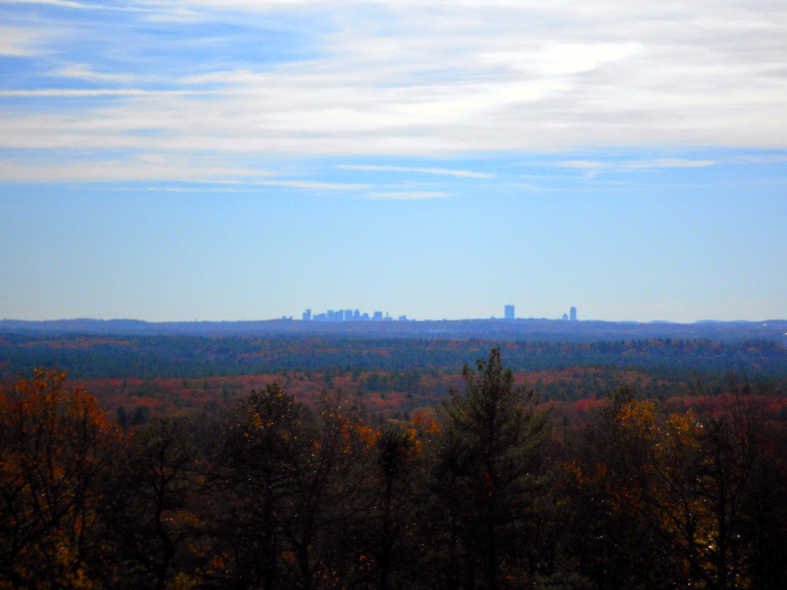
 View of Boston 20+ miles south of Holt Hill.

 Remains of old chair lift on Boston Hill.

 Long walk down to the Bog Trail.

More photos and video of my Ward Reservation wandering are HERE

Saturday, October 4, 2014

Norwottuck Rail Trail Ride

Early this summer I enjoyed a leisurely ride through the towns of Northampton, Hadley, Amherst and Belchertown along the 11 mile Norwottuck Rail Trail. It was a very scenic ride though dense woods and farmlands with majestic views of the mountains in the Holyoke range. The most dramatic half mile of the ride occurred while crossing the Connecticut River on a newly constructed traffic-free bridge. Spectacular!  I highly recommend a side trip to the Black Sheep Deli in Amhert (about a half mile off trail) for lunch and Maple Farm Foods in Hadely (on trail) for ice cream!


Nicely shaded wooded section of trail.


One of the many corn fields along side the trail.


Enjoy an ice cream and the view of the Holyoke Range on a conveniently located bench.


Crossing the Connecticut River.


Nice view of the mighty Connecticut River.


An escapee from a local farm?

More on-trail wildlife.


Beautiful flower garden on trail.


Me at the Belchertown trail head. Chicks dig my Black Butte Porter cycling jersey!

Ride on!

Tuesday, September 16, 2014

Bay Circuit Trail Hike Map 10 & 11 - Route 1, Walpole to Borderland State Park, Easton

I’ve been away from the Bay Circuit Trail (BCT) for over four months. I’m not a fan of doing long hikes in the summer heat and humidity so I took a break. During this extended absence I planned how to split the remaining miles of the trail into manageable day hikes. It’s not as easy as you may think, given it’s a linear trail and I often hike point to point on my own. One ‘interesting’ thing I discovered during the planning process was that the BCT is actually closer to 230 miles long, not the 200 mile distance reported by the Bay Circuit Alliance back when I started the trail in 2011. The AMC has recently updated the BCT website and now reports the distance at 230+ miles. I’m not sure if the additional 30 miles resulted from re-routes over the years or some other factor.  It’s not a big deal, but it means I’ll have to do two more hikes than I originally planned. Not a bad thing at all.

176 completed miles on the Bay Circuit Trail.


This time my daughter joined me and we got dropped off on Route 1 in Walpole where we ended the last hike. The first mile was on a quiet back road which led us to a private driveway before we entered the woods. We passed by an underground house built into the sloping earth in the early 1970s. It was a bit strange to see a stone chimney sticking out of the ground with nothing else around it.

Underground house. The 'roof' is lawn.


At the end of the private drive the trail entered a wooded area adjacent to Moose Hill Wildlife Sanctuary. It was very spongy underfoot due to a thick bed of pine needles. I knew most of the day would likely involve walking on rocks and roots so I enjoyed this moment while it lasted. After crossing a road we entered into Moose Hill proper and began a series of ascents and descents. None were particular long but they were often steep. The high point of the day was reached at the summit of Moose Hill (534 ft) but sadly it was treed in and there were no views. I was somewhat surprised by the difficulty of the trails in Moose Hill but walking five continuous miles of single-track was an unexpected treat!

Pine needles and downhill! What more could you ask for?

 Stone chimney on an overlook called Allen's Ledge.

 View from Allen's Ledge.

Fire tower on Moose Hill.

 Plenty of up and down early on but pretty smooth the second half.

The next section involved a long road walk paralleling Massapoag Lake. Normally, I dislike the road walks but this one wasn’t bad as I was distracted by pleasant views of the lake and a few stately homes just across the street. About two miles later, we entered Borderland State Park for the final leg of the hike. The trail in Borderland was not as undulating as it was in Moose Hill. What it lacked in topography, it more than made up for with rocks and roots! I kept stubbing my toe on various rocks and roots as I often do when I begin to fatigue. After five hours of continuous movement I was pleased to see the park Headquarters Building which marked the end point for today’s hike.

 Massapoag Lake
 
The trail in Borderland, and for this entire 13 mile section of the BCT, was very well marked. I never went off-trail and needed to refer to the trail guide only on a few occasions. This hike was more about spending time with my daughter than documenting the trail so I didn’t take many photographs. You’ll just have to get out there and see it for yourself.

Happy Trails!

Stats: BCT Maps 10 & 11: 13.2 miles  
Surface split: 9.7m trails, 3.5m roads  
Elevation gain: 784 feet  
Highest point: Moose Hill 534 ft.  
Start point: Route 1, Walpole  
End point: Borderland State Park, Easton  
Other towns: Sharon  
Green Spaces: Moose Hill Wildlife Sanctuary, Deborah Sampson Park, Borderland State Park  
Hydration: 40 oz water  
Fuel: Two Cilff Bars  
Footwear: Scarpa Spark, Wright socks  
Total BCT covered to date: 176 miles  
Surface split: 105 trail and dirt road, 64 pavement, 7 paved rail trail  
Total elevation gain: 7693+  
Highest point: Nobscot Hill 602 ft  
BCT remaining: 54m estimated

Wednesday, August 20, 2014

Gear Review - Scarpa Spark Trail Shoes

Ever since I wore through the last of my stockpiled Cascadia 5s I’ve been looking for a suitable replacement. It’s been a long and exhausting search for that perfect shoe (if such a thing exists) but I’ve finally found something I can live with, at least temporarily. It’s the Scarpa Spark. Most of you have probably never heard of Scarpa but the Italian company has been making quality mountaineering, skiing, hiking and trekking boots and shoes for seventy years.
  

I’ve been a traditional shoe wearer for years and have never been able to wear any of the minimalist shoes that have become so popular since the book “Born to Run” was published. Low and no drop running shoes cause my plantar fascia to flare up. The Spark, with its 6mm heel drop, is a good compromise between a minimalist and traditional shoe. It hasn’t caused any plantar fasciitis problems for me. I also like that the shoe is so much lighter than my Cascadias.


The Spark fits securely though the heel and mid-foot but has a high volume toe box so your toes don’t feel squished. The uppers drain quickly and breathe well but may not be very durable. I jammed my foot between two sharp rocks on a recent hike and damaged the shoe almost to the point of tearing a hole in the mesh. The sticky rubber sole grips extremely well on wet roots and rocky surfaces but is lacking when it comes to muddy trails. The 2.5mm lugs just aren’t big enough to dig in deep for a secure grip.


Photo credits: Trail Runner Nation


If I have one complaint with the shoe it’s with the hi-tensile fabric strike plate. Sure it saves weight, but it doesn’t offer same the foot protection as a high density EVA plate would. It may not be problem for runners/hikers without any foot issues but after a long day on a rocky trail or mountain, the neuromas in my feet become painful due to the lack of protection.  To their credit, I don’t have any foot issues on smoother trails.

Likes:

  • Lightweight
  • Roomy toe box\
  • Sticky rubber sole
  • Drains well

Dislikes:

  • Inadequate strike plate
  • 2.5mm lugs lacking in deep mud

Disclosure: The author owns this product and purchased it with his own funds.

Sunday, August 3, 2014

Two Days,Two Hikes. One Bad,One Good. Both Humid as Heck!

I was hoping to do and overnight hike on the Monadnock-Sunapee Trail this week but the weather looked very iffy so I decided to stick close to home and do two short hikes instead.  

The first hike, at Hale Reservation & Noanet Woodlands, was also my first time visiting the area. These adjacent properties in Westwood and Dover MA offer many miles of trails to explore. The fact that they are only an hour drive from my house was a bonus. I have to say I was disappointed with the hike. Much to my surprise there was very little topography and I was quickly bored with the flat trails. I'm not sure if the super humid air had anything to do with it but the biting insects were out in full force. They attacked me relentlessly throughout the morning and forced me to shorten the hike from the planned 10 miles down to around 6.5. I was never so happy to get out of the woods!

 Hale/Noanet Route


 View of Storrow Pond through the trees.

Calm on Storrow Pond.

 Giant erratic, perhaps 20 feet high.

Collapsed pavilion on Strawberry Hill Trail.

The second hike was at Breakheart Reservation in Saugus. I haven't been to Breakheart in three years and it was nice to be back. One notable change since my last visit here is the presence of beaver in the Saugus River. The ranger told me they have been there for two years. Beavers can be a nuisance and create problems but I really like the chubby rodents. Breakheart can be a very busy place on the weekend but the moring rain kept most people away. I have found hiking on a raining day to be a very peaceful time for me. I should do it more often. 

Breakheart Route

Climbing Breakheart Hill Trail in the rain.

 Remains of old motor and chassis used to operate a rope tow when Breakheart Hill was used for skiing in the 60s.

 Inline six with pistons frozen in place.

 Another large erratic. Note trekking poles on left for scale.

  Steps on the Fox Run Trail. Another change since my last visit.

Looking down on Pearce Lake from Eagle Rock.

 Pearce Lake

Silver Lake

Beaver Dam on Saugus River
Hike on!
Related Posts Plugin for WordPress, Blogger...