The fabulous four (Nancy, Bill, Tony and I) returned for our nineth ride on Bay Circuit Trail. This ride would differ from the previous eight as we decided to spot cars and do a point-to-point ride. All our rides up to this day had been loops, heading out on the BCT to a designated point, then returning via roads back to the starting point and our cars. Although convenient, this method added considerable miles that did not contribute to us reaching our final destination, the southern terminus of the BCT.
Route overview - Red indicates paved, Blue is unpaved
The ride began with a fast, one-mile paved downhill from the Moose Hill Audubon parking lot to Beaver Brook Watershed Land. In contrast to the first mile, the second mile through Beaverbrook was a slow grind on single-track laced with rock and roots and steep climbs up to 17%. For some of us (me included), this required a hike-a-bike over the steepest sections.
Nancy pushing up a steep section of trail.
Tony was able to ride it!
We missed this turn into an overground section of trail.
Once leaving Beaver Brook, we rode smooth, wide trails through the Sharon dog park, which took us to Memorial Beach. From here the BCT turns onto a paved section of road that parallels Lake Massapoag for one mile. In Algonquin, the word Massapoag means large water. True to its name, Lake Massapoag is a 392-acre natural stream and spring fed lake.
Riding past the lake front properties.
The next five miles through Borderland State Park were some of the most difficult biking of the day. Most of the singletrack is rated as expert mountain biking trail. Unfortunately, none of us are expert mountain bikers! Needless to say, this section took quite a while to complete as we had to lift our bikes over large boulders and walk the steep descents. We eventually came to some smooth riding as we neared the Park Ranger headquarters.
It was appropriate for Mr. Morse to lead us down the Morse Trail.
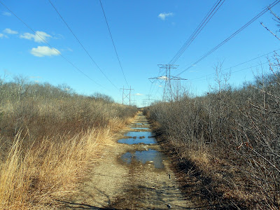
The next 10 miles were slightly easier but still difficult. We had to navigate through the unmarked and difficult to follow trails in Beaver Brook Woods and the washboard, sandy track though Hockomock Swamp. This section was made more difficult as the utility company that maintains the power lines had filled in sections of the trail with softball sized rocks, making it difficult for the gravel tire bikes to pass. Bill and Tony didn’t seem to have much difficulty with it, but I did wait up for Nancy a few times as she was more cautious through these rocky sections.
All these depressions are now filled with large stones. (Picture of Hockomock Swamp Trail taken from 2016 hike.)
It was an unseasonably warm day, and the heat was taking a toll on Nancy. She began cramping in her legs and feet, and riding became more difficult for her. After some road riding through the Bridgewaters, she decided to call it a day and stop at a roadside ice cream shop! The three boys pressed on as we needed to get to Nancy’s car in Hanson, so one of us could pick her up.
There were trail notices posted on the BCT website relevant to the trail ahead of us. We were unsure if we would be able to continue due to a collapsed bridge in Poor Meadowbrook Wildlife area and also flooding in another section. Taking the trail sections back to Hanson would be risky and require additional time. Instead, we decided to take seven miles of paved roads back to minimize the wait time for Nancy.
In the end, our detour off the BCT didn’t change the total miles for the ride, but did eliminate some off-road sections in lieu of roads. We we’re all happy to be finished with this ride as it proved to be more difficult than we expected. Only one more section remains before we reach the southern terminus at Bay Farm!
Ride Summary:
Day 9 - 34.7 miles, 185.0 cumulative.
Paved - 20.0 miles, 101.8 cumulative.
Unpaved - 14.7 miles, 83.2 cumulative.
Elevation gain - 1,071 feet, 11,356 cumulative.
Max grade - 17.1%
High point - Moose Hill Parkway, Sharon 363 feet
Towns traversed - Sharon, The Bridgewaters and Hanson
Green spaces visited - Beaver Brook Watershed Land, Borderland State Park, Fox Mountain Conservation Area, Furnace Village Management Area, Wheaton Farm Management Area and Hockomock Swamp Wildlife Management Area


